
A Three Overlook Hike in Prentice Cooper State Forest
Just a few miles west of downtown Chattanooga lies the approximately 25,000-acre Prentice Cooper State Forest and Wildlife Management Area, known to locals as simply Prentice Cooper. Popular for a variety of outdoor recreation uses, including hunting, horseback riding and off-roading, Prentice Cooper contains over 35 miles of hiking trails.
The Prentice Cooper trail network, considered part of the Cumberland Trail system, is primarily designed for longer hikes of 10 miles or more. But with a little research and willingness to do an out-and-back hike or to incorporate sections of jeep road into a loop, one can find good shorter hikes, such as this recommended 5.4-mile hike that takes in three great overlooks.
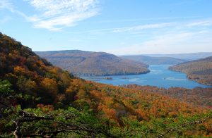
The trailhead for this hike is about 6 miles in on the 10-mile graveled Tower Drive, at the parking area adjacent to the road to Snoopers Rock. The trail that crosses here is part of both the 10.2-mile Mullins Cove Loop Trail and the 11.9-mile Pot Point Loop Trail. Heading west for 0.6 miles will bring you to the fork in the trail, with the Mullins Cove Trail going right and the Pot Point Trail turning left. Continuing to the right and through the Hemlock Branch Backcountry Campsite for a half-mile will take you to the Mullins Cove Overlook, which has an impressive view, shown left.
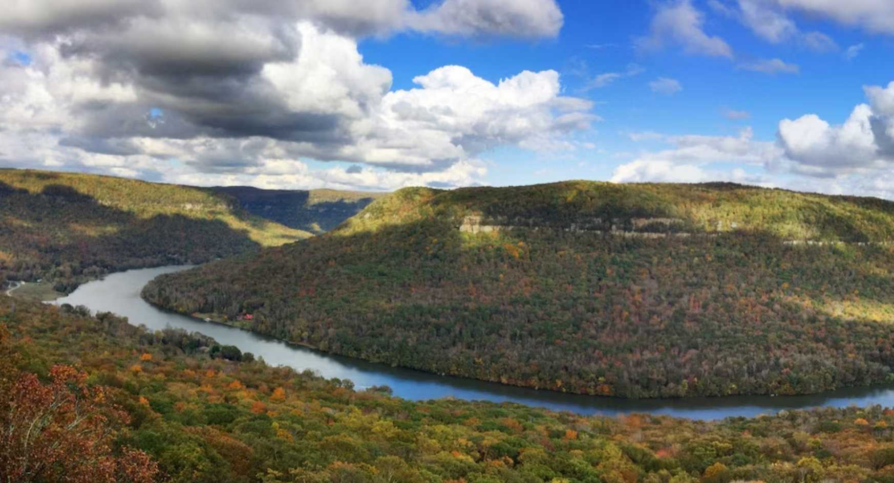
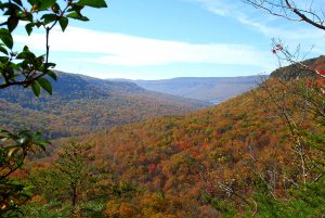
After retracing your steps from here, turn right in 0.5 miles at the trail intersection and follow the Pot Point Trail south for 1.3 miles. Much of this section is along slopes beneath the top of the plateau, and is one of the few places in the Cumberlands where rhododendron can be found. Watch for a spur trail on the right, which leads to Ransom Hollow Overlook. If you’ve timed things right, this is a great place for a lunch break. From here you can see the Tennessee River and Mullins Cove, with an expansive view that includes a wide swath of Prentice Cooper, Aetna Mountain across the river, Cedar Mountain, and Jasper Mountain on the far horizon.
From Ransom Hollow Overlook, return the way you came for 1.9 miles to the trailhead where you parked. Here, perhaps depending on how tired you may be, you have three options for visiting the high point of the hike, Snoopers Rock Overlook. You can cross the road and continue on the trail for 0.3 miles to Snoopers Rock or hike the parallel jeep road. You can even drive the gravel jeep road to a parking area just a few yards from the overlook. Snoopers Rock, which got its name back in the days of moonshine runners and revenuers, is one of the most popular overlooks in the Tennessee River Gorge.
Alternative Route
If you’re feeling a bit adventurous and really prefer to do a loop trail, there is an alternative available for returning from Ransom Hollow Overlook. Upon leaving the overlook and reaching the main trail, you can continue across the trail and on an abandoned jeep road up a fairly steep hill. This road has been closed to vehicular use but is still usable for hiking. After leveling out a bit, the trail reaches Tower Drive in about a half-mile. You may have to bushwhack through about 10 feet of brush to get out onto the Tower Drive right of way. Here, you can simply walk Tower Drive for about 1.25 miles back to your car.
The main drawbacks to walking Tower Drive are dust from passing traffic and being in the sun if you’re doing this in the summer.
Note: Prentice Cooper is closed periodically for non-hunting uses during scheduled deer or turkey hunts. Check the Prentice Cooper website for scheduled hunt closures.
Directions
From Signal Mountain Road in Chattanooga, take Highway 27 west for about 8 miles, following alongside the Tennessee River, then up Suck Creek Mountain. At the top of the mountain, look for the Prentice Cooper State Forest and Wildlife Management Area sign on the left. After turning left, bear left at the next intersection, then look for another Prentice Cooper sign at the next left. The road starts out paved but quickly turns to gravel. As pointed out earlier, it’s about another 6 miles to the trailhead for this hike.
Article by Bob Butters

Recent Posts

 North Chickamauga Creek Gorge State ParkJanuary 14, 2025
 Savage Gulf State ParkNovember 4, 2024
 Bike TNMay 23, 2024
 Cookie Jar Cafe Grand Reopening!February 9, 2024
 Authentic AppalachiaOctober 31, 2023