
Hiking Oswald Dome Trail ~ Cherokee National Forest
Driving east from Cleveland into Polk County, the western edge of the Blue Ridge Mountains rises abruptly on the horizon. To the north of U.S. Highway 64 and the Ocoee River, the Cherokee National Forest’s Chilhowee Mountain is home to a popular mountain top recreation area of the same name.
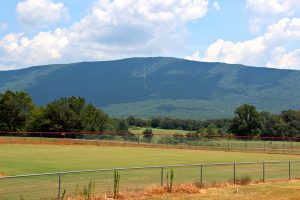 The northern end of the mountain, officially called Bean Mountain, is capped by the knob known as Oswald Dome, which reaches an elevation of approximately 3,000 feet. Once the location of a very tall fire tower, of which the top part is now an attraction at the Ocoee Whitewater Center, Oswald Dome is currently the site of over a half-dozen communication towers.
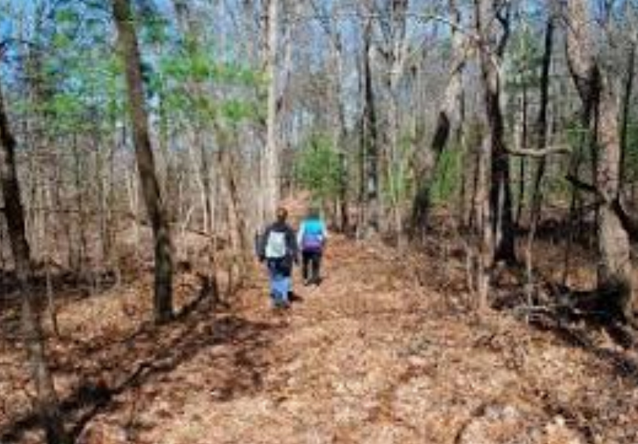
 While you may have driven there over the nearly five miles of bumpy dirt road from the Chilhowee Recreation Area, you may be unaware that you can also hike there from Highway 30 near the Hiwassee River. The Oswald Dome Trail ascends from the Quinn Springs Recreation Area and gains approximately 2,200 feet in elevation in just under four miles. While an experienced hiker would probably be up for the round-trip hike of nearly eight miles, an easier hike would be to do it one way with a car shuttle. The following description is for the downhill option.
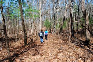 The road to Oswald Dome is gated about a quarter-mile before reaching the top, at the intersection with another gated road on the right. Park here and walk the road uphill until you see the Oswald Dome Trail sign on the right. The first third to half of the hike is fairly easy and follows the western edge of the mountain north, with a gradual downhill slope. In winter, you may get an occasional glimpse west across the expansive Tennessee Valley.
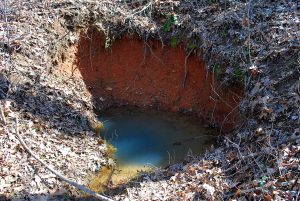
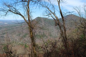
 Eventually, the trail begins to decline a bit more steeply. While not too strenuous for the experienced hiker, the second half to two thirds of the hike steadily descends toward the Hiwassee River with several switchbacks and a brief scenic view or two along the way. At the turn of one switchback, an area is kept cleared of trees, providing a year round panoramic view to the west. Shortly before reaching the trailhead at Quinn Springs, the trail passes directly in front of one of the area’s namesake springs.
 The trail is known for wildflowers in season, with up to 74 species of blooming plants reported some years. The forest through which it passes is primarily mixed hardwood, with a few stands of pine on the lower slopes, along with the occasional rhododendron. Note: while some trails in the Cherokee National Forest are open to horses and mountain bikes, the Oswald Dome Trail is hiking only.
 Quinn Springs Recreation Area is basically a picnic area and pavilion. The campground there has been closed since 2013. Upon entering the area, turn left and you’ll see a parking area with restrooms at the far end. The trailhead is to the right end of the parking area, opposite from the restrooms.
Google Maps shows the shortest driving route from Quinn Springs to Oswald Dome, at just over 13 miles, being to take Hwy. 30 through Reliance, then a gravel Forest Service road up the mountain. Unless you’re familiar with the road conditions of that route, a safer bet may be to take U.S. 411 to Benton, then the gravel road up Chilhowee Mountain and the 4.8 miles of mountain top dirt road between Chilhowee Recreation Area and Oswald Dome, a total distance of about 18 miles. If you’re uncomfortable with driving a dirt road up the side of the mountain, you can continue down Hwy. 314 to U.S. 64, then take the paved road which turns left just past the Ocoee Ranger Station. For driving the dirt road to Oswald Dome, a pickup truck or SUV is recommended.
GPS for Quinn Springs: 35.228883,-84.545683.
For the Oswald Dome gate: 35.190736,-84.555472.
For contacts and other information about the Cherokee National Forest, visit www.fs.usda.gov/cherokee.
Article by Bob Butters

Recent Posts

 Discover Ten Mile, Tennessee: The Hidden Lakefront Gem of Meigs CountyOctober 23, 2025
 Discover Copperhill, Tennessee: History, Train Rides, and Riverfront CharmJuly 28, 2025
 Discover Calhoun: Tennessee’s Hidden Riverfront GemJuly 10, 2025
 Murals in Southeast TNJuly 7, 2025
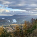 North Chickamauga Creek Gorge State ParkJanuary 14, 2025