

Hiking at Laurel-Snow State Natural Area
Located just outside of Dayton, Tenn., Laurel-Snow State Natural Area is a popular hiking area featuring blue holes, waterfalls and historic mining structures that date back to the late 1800s and early 1900s.
Laurel-Snow State Natural Area is located in a gorge that is cut into Walden’s Ridge. A number of creeks cut through the gorge: Richland, Polebridge, Morgan, Henderson and Laurel creeks.
Overall, the natural area contains 10.5 miles of hiking trails, but Laurel Falls can be reached with a moderate 4.8-mile round-trip hike. White blazes mark the trail (although there are a few sections that are not well-marked).
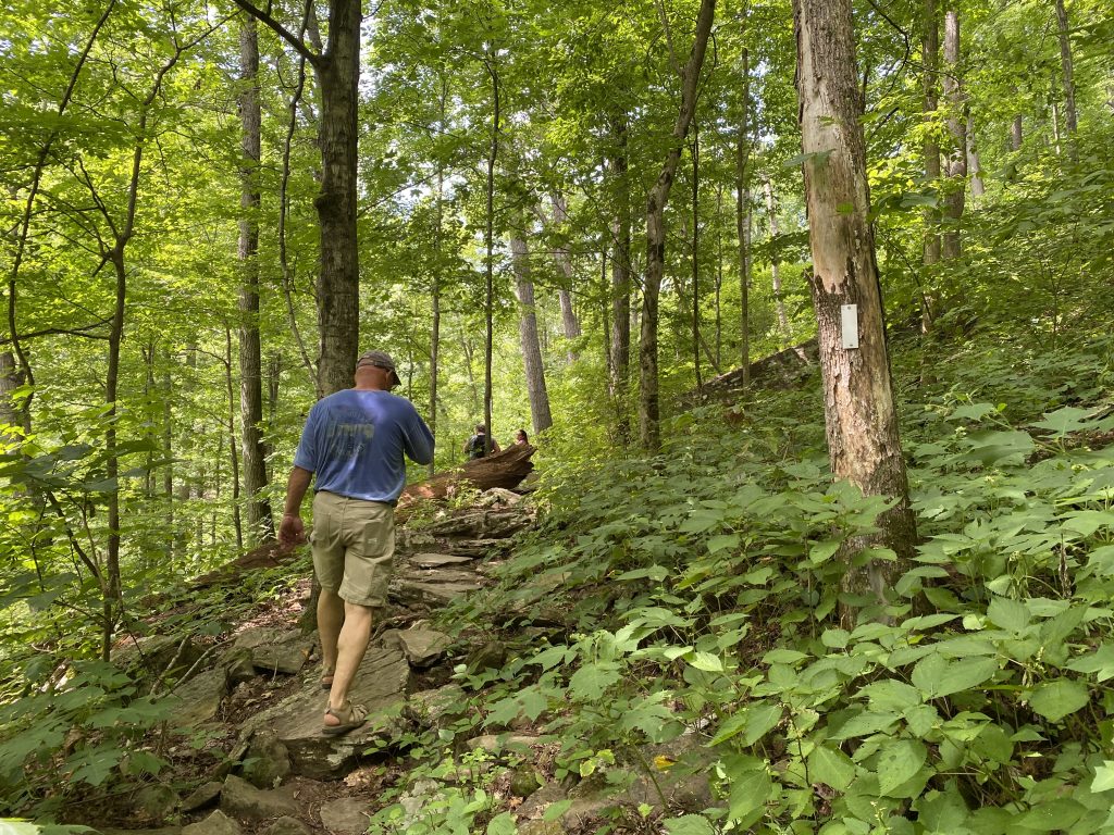
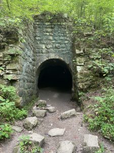
From the trailhead, the trail is fairly level and wide as it runs alongside Richland Creek on an old railroad bed, a reminder of the area’s coal mining history. After passing some historic stone walls, at 0.2 miles, there is an old mine entrance on the right side of the trail. While ungated, it is not considered safe to enter the mine.
At 1.2 miles, the trail becomes more narrow and rugged as it climbs steeply to the right (this section is not well-marked).
Continuing along the main trail, at mile 1.7 the trail crosses a metal bridge over Laurel Creek, just after which it reaches an intersection. Turning left takes you past Henderson Creek Campsite to a 150-foot bridge across Henderson Creek, and eventually to the top of the mountain.
At this point, spur trail options include Dunn Overlook, Morgan Creek Campsite, the 35-foot Snow Falls, and Buzzard Point Overlook, with its spectacular view through the gorge and across the Tennessee Valley. Find a map and a detailed description of this section of trail here.
To reach Laurel Falls, turn right after crossing the bridge. The trail follows Laurel Creek for a bit, at one point going through an interesting cave-like hole under a large boulder. You can detour around this, but it isn’t necessarily easier.
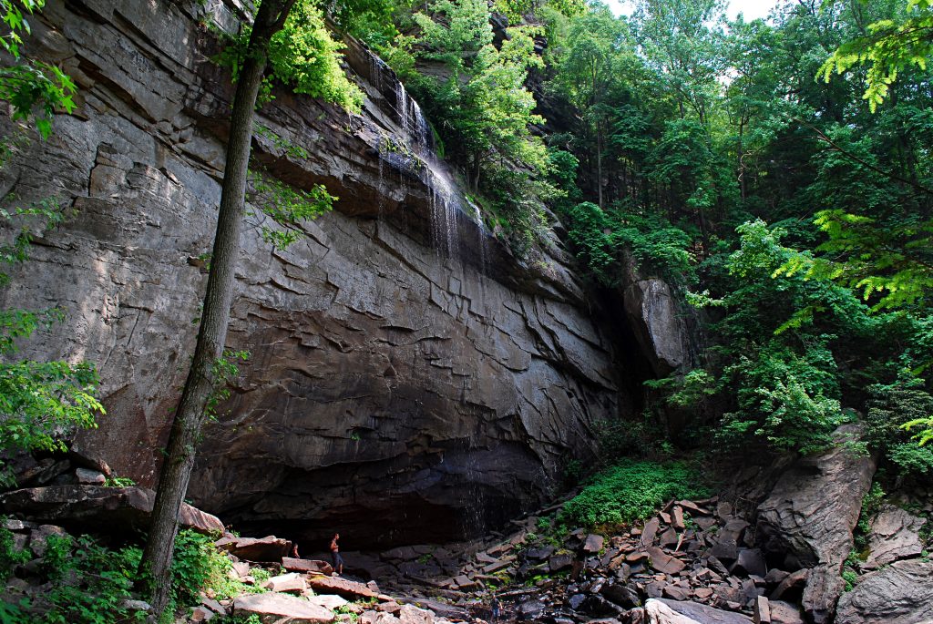
As the trail works its way back into Laurel Gorge, it gains significant elevation with a series of switchbacks. Avoid the temptation to use some of the visible shortcuts, as it won’t make the climb easier. In 0.7 miles, or 2.4 since starting the hike, you reach the base of Laurel Falls.
Shortly before reaching the falls, the main trail turns left. If you elect to continue on it, you’ll do a bit more climbing, pass Laurel Creek Campsite, ford Laurel Creek above the falls, pass the Laurel Creek Overlook, and in 0.9 miles, or 3.3 from the trailhead, reach Bryan Overlook, the end of the trail.
Click here for a map and detailed description of this section.
During dry times, Laurel Falls may contain a disappointing amount of water, considering its 80-foot drop, but the impressive rock face and gigantic boulders jumbled in the ravine below still make it a worthwhile destination. If it’s a hot summer day, you may wish to take advantage of some of the wading or swimming opportunities presented by Richland Creek on the hike out.
Laurel-Snow State Natural Area is open daily 8 am – 7 pm Eastern Time. Overnight camping permits can be obtained through the Friends of the Cumberland Trail website.
During summer months the trailhead parking area can get crowded, so it’s recommended to go early in the day or on a weekday.
Find more information, including a trail map and descriptions, and a map and directions to the trailhead here. Click here to view an interactive GIS map of the entire Cumberland Trail system, including the Laurel-Snow Trail.
Article By Bob Butters, The Nickajack Naturalist
Recent Posts

 Photo Contest 2025April 4, 2025
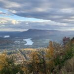 North Chickamauga Creek Gorge State ParkJanuary 14, 2025
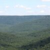 Savage Gulf State ParkNovember 4, 2024
 Bike TNMay 23, 2024
 Cookie Jar Cafe Grand Reopening!February 9, 2024